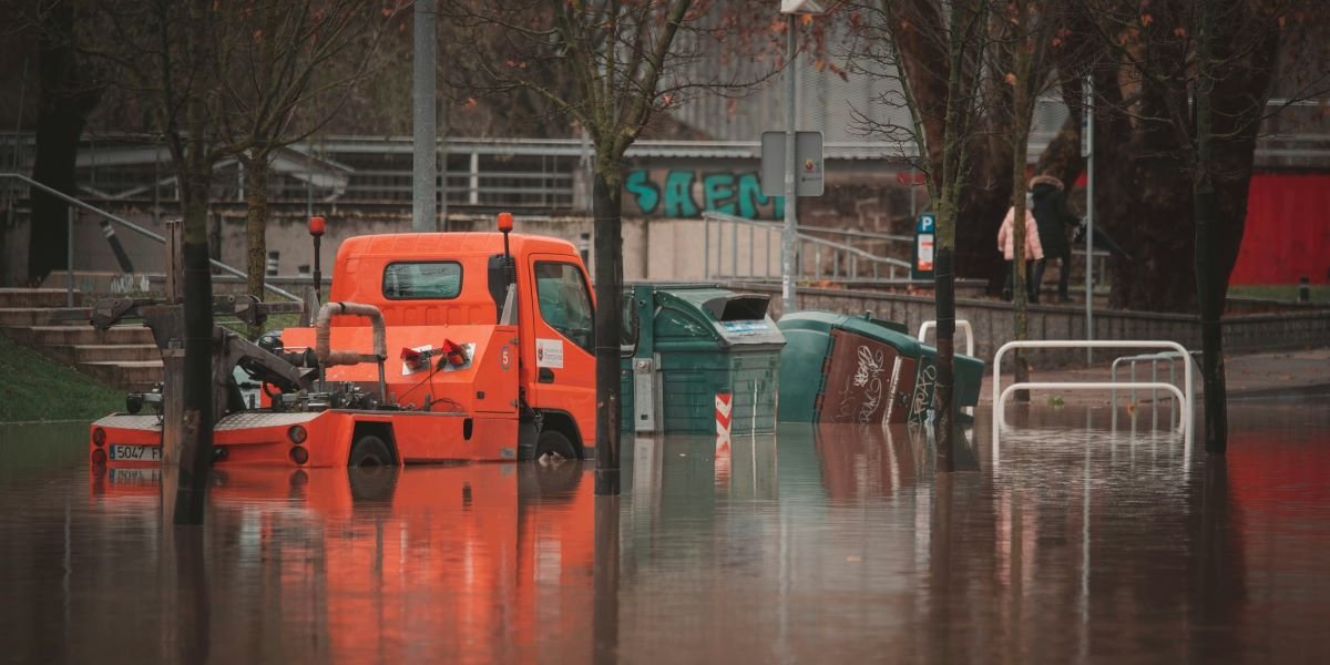
Forty-seven American nationals are among more than 400 people reported missing after catastrophic flash flooding swept through Nepal’s northern Rasuwa and Nuwakot districts on August 26, 2026, killing at least 157 people. The flooding was triggered when a massive wall of mud and rock collapsed into the Bhote Koshi River along the Nepal-China border at approximately 8:30 a.m. local time, sending a surge of water through valleys, villages, roads, and hydropower infrastructure. The U.S. State Department said it is aware of Americans affected and is monitoring the situation closely.
Key Takeaways
- At least 157 bodies have been recovered in Nepal after flash flooding destroyed villages, roads, bridges, and power plants across Rasuwa, Nuwakot, and Dhading districts on August 26; Chinese state media reported additional casualties at the Gyirong border crossing in Tibet.
- Nepal’s Tourism Board reported 403 people missing, including 341 foreign nationals: 133 from India, 47 from the United States, 34 from Australia, 33 from the United Kingdom, 24 from Canada, 19 from Malaysia, 9 from South Korea, 4 from Germany, and 1 from Israel.
- Secretary of State Marco Rubio posted on social media that the State Department “stands ready to support the government of Nepal with needed humanitarian assistance.”
- The U.S. Geological Survey initially reported a magnitude 4.4 earthquake approximately 66 kilometers north of Kathmandu, then updated the event to a 5.2 magnitude landslide, consistent with the glacial collapse trigger identified by regional scientists.
- Most missing foreign nationals are believed to have been on the Mount Kailash pilgrimage route through Rasuwa district to the Tibetan border.
- The same river system flooded 14 months earlier, in August 2025, when a glacial lake in Tibet overflowed due to high temperatures, killing 9 people.
The State Department Response and What Is Known About the 47 Missing Americans
Nepal Tourism Board spokesperson Sunil Sharma confirmed to multiple outlets that 47 U.S. nationals are among the missing, citing information compiled from tour operators and trekking agencies operating in the affected region. A State Department spokesperson told reporters that the department is aware of Americans impacted by the flooding and is closely monitoring the situation but did not provide details on the number or condition of the U.S. citizens involved.
Secretary of State Marco Rubio posted a public statement expressing solidarity with the Nepali people and confirming that the department “stands ready to support the government of Nepal with needed humanitarian assistance.” A separate State Department statement said the administration has “no higher priority than the safety and security of Americans.” Neither statement specified whether consular teams have been deployed to the affected region or whether any of the 47 Americans have been located.
The affected area presents severe challenges for search and rescue operations. Rasuwa district sits in Nepal’s mountainous northern belt, where roads are narrow, landslide-prone, and in many cases the only access route to remote settlements. The flooding destroyed road infrastructure, bridges, and communications lines, isolating communities and limiting the ability of rescue teams to reach the hardest-hit zones. The 47 missing Americans are believed to have been among the hundreds of foreign tourists trekking through Rasuwa on the pilgrimage route to Mount Kailash in Tibet, a sacred Hindu site that draws international visitors during the late summer season.
How the Flood Unfolded: A Wall of Mud at the Nepal-China Border
The disaster began at approximately 8:30 a.m. local time on Wednesday, roughly 10:45 p.m. Eastern Time Tuesday night. A massive volume of mud, ice, and rock collapsed into the Bhote Koshi River in Nepal’s northernmost reaches, near the border crossing at Rasuwagadhi. The surge traveled downstream through the Bhote Koshi and into the Trishuli River system, destroying everything in its path. The flood struck the settlements of Rasuwagadhi, Timure, and Syafrubesi in Rasuwa district before continuing into Nuwakot and Dhading districts.
Verified videos circulated on social media and broadcast by regional outlets showed violent torrents of water surging through narrow valleys and mountain passes, tearing down bridges and dams and sweeping away multi-story buildings. One widely shared video showed dozens of people attempting to flee an incoming wall of mud at the border. Shoyam Rajbhandari, a resident of the Dhunge Bazaar area, described the speed of the surge. The flood reached his market area within half an hour, destroying the commercial district as people were still preparing for the morning.
The U.S. Geological Survey initially classified the event as a magnitude 4.4 earthquake centered approximately 66 kilometers north of Kathmandu. The agency later reclassified the seismic event as a 5.2 magnitude landslide, consistent with the assessment from the International Centre for Integrated Mountain Development in Kathmandu, which identified the trigger as an ice-rock avalanche that blocked the Lhende Khola, a tributary of the Bhote Koshi, before the blockage failed and released the impounded water downstream in a concentrated surge.
The Missing: Pilgrims, Trekkers, and Workers From More Than a Dozen Countries
The scale of the missing-persons count reflects the timing and geography of the disaster. August is peak season for the Mount Kailash pilgrimage, which follows a route through Rasuwa district to the Gyirong crossing into Tibet. The majority of the 133 missing Indian nationals are believed to have been pilgrims on this route. The 47 Americans, 34 Australians, 33 British nationals, and 24 Canadians likely include a mix of pilgrims and trekkers, though the specific activities of individual missing persons have not been publicly detailed.
Nine South Korean nationals reported missing were working on a hydropower construction project in the region, according to South Korean government officials. Malaysia’s Foreign Ministry confirmed that its embassy in Kathmandu received reports from travel agencies that 19 Malaysians in Rasuwa had lost contact. An additional 62 missing Nepali citizens were among hundreds of locals trekking in the Gosaikunda Lake area of Rasuwa district, a popular hiking destination that sits within the flood-affected zone.
Nepal’s narrow river valleys function as both economic lifelines and travel corridors, concentrating settlements, infrastructure, tourism, and transportation along the same paths that floodwaters follow when disaster strikes. The same geography that makes the Rasuwa corridor attractive to pilgrims and trekkers, dramatic Himalayan scenery, cultural significance, and proximity to the Tibetan border, also makes it acutely vulnerable when glacial events send surges of water and debris through confined valleys with limited escape routes.
International Rescue Response Takes Shape
Nepal’s government formally requested rescue assistance from both India and China within hours of the flooding. Nepal’s government spokesperson Sasmit Pokharel confirmed the requests, and both countries responded publicly. Indian Prime Minister Narendra Modi spoke with Nepali Prime Minister Balendra Shah and said India “stands in solidarity” and is ready to provide humanitarian assistance. China deployed 574 rescuers to the Gyirong border crossing on the Tibetan side, though one rescuer told state broadcaster CCTV that it would take hours to reach the most heavily affected areas.
The European Commission activated Copernicus, the European Union’s satellite mapping service, to help assess the affected areas in Nepal and support the response on the ground. European Commission President Ursula von der Leyen said Europe is ready to mobilize additional assistance. The multinational response reflects both the scale of the disaster and the international composition of the missing-persons list, which includes nationals from at least nine countries spanning North America, Europe, South Asia, East Asia, Southeast Asia, and the Middle East.
On the ground, the immediate challenge is access. Destroyed roads and bridges have cut off the most severely affected areas from overland rescue routes, forcing responders to rely on helicopters and foot patrols to reach isolated communities. Communications infrastructure in the region is also damaged, complicating efforts to establish contact with missing persons who may be alive but unable to reach functional phone or internet connections. The death toll of 157 is expected to rise as rescue teams reach areas that have been inaccessible since the flooding began.
A River That Has Flooded Twice in 14 Months
The Bhote Koshi and its tributary the Lhende Khola have now produced catastrophic flooding twice in 14 months. In August 2025, a glacial lake in neighboring Tibet overflowed due to high temperatures, sending floodwaters down the same river system. That event killed 9 people and destroyed a bridge connecting Nepal and China. The 2025 flood was classified as a glacial lake outburst, a different mechanism from the 2026 ice-rock avalanche, but the downstream path was the same and the affected communities were the same.
The recurrence raises a question that extends beyond Nepal’s borders. Hindu Kush Himalaya glaciers are losing ice at rates that have doubled since 2000, driven by regional temperatures that are rising faster than the global average. The accelerating melt destabilizes both glacial lakes and the ice masses themselves, increasing the frequency of both outburst floods and avalanche-triggered events. For the 47 American families waiting for news, the climate science is abstract. The immediate reality is that their relatives were in a valley that has now flooded catastrophically twice in just over a year, and the communications infrastructure that would allow contact has been destroyed.
Frequently Asked Questions
How many Americans are missing in the Nepal floods?
Nepal’s Tourism Board reported 47 U.S. nationals among the 403 people missing after the August 26 flash floods. The U.S. State Department confirmed it is aware of Americans affected and is monitoring the situation but has not released an independent count.
What caused the flooding?
The International Centre for Integrated Mountain Development identified the cause as an ice-rock avalanche that blocked the Lhende Khola tributary of the Bhote Koshi River. When the blockage collapsed, it released a concentrated surge of water, mud, and rock downstream into the Trishuli River system. The U.S. Geological Survey reclassified the seismic event from a magnitude 4.4 earthquake to a 5.2 magnitude landslide.
What has the U.S. government said?
Secretary of State Marco Rubio said the State Department “stands ready to support the government of Nepal with needed humanitarian assistance.” A department spokesperson said the administration has “no higher priority than the safety and security of Americans” and is closely monitoring the situation.
Why were so many foreign tourists in the area?
Rasuwa district sits along the pilgrimage route to Mount Kailash in Tibet, a sacred Hindu site. August is peak season for the Kailash trek, and most missing foreign nationals are believed to have been pilgrims or trekkers using the route through Rasuwa to the Gyirong border crossing.
Has this area flooded before?
Yes. The same river system flooded in August 2025 when a glacial lake in Tibet overflowed due to high temperatures, killing 9 people and destroying a bridge connecting Nepal and China. Climate researchers have documented that Himalayan glaciers are losing ice at double the rate observed before 2000.